BY SANDY MCRUER
SPECIAL TO THE NEWS
Pretty much everyone who reads this column is aware of the Alberni Inlet Trail. For those of you who aren’t, you are missing a wonderful trail.
The Inlet Trail meanders almost 30 kilometres down the eastern side of the Alberni inlet, the longest inlet on Vancouver Island. It consists of three stages, two of which are complete. And currently, Stage 2, is closed at the south end until approximately the end of June due to nearby logging. Although it is an iconic trail with all the things that people who live on Vancouver Island and those who visit it want to experience, it is still a work in the making.
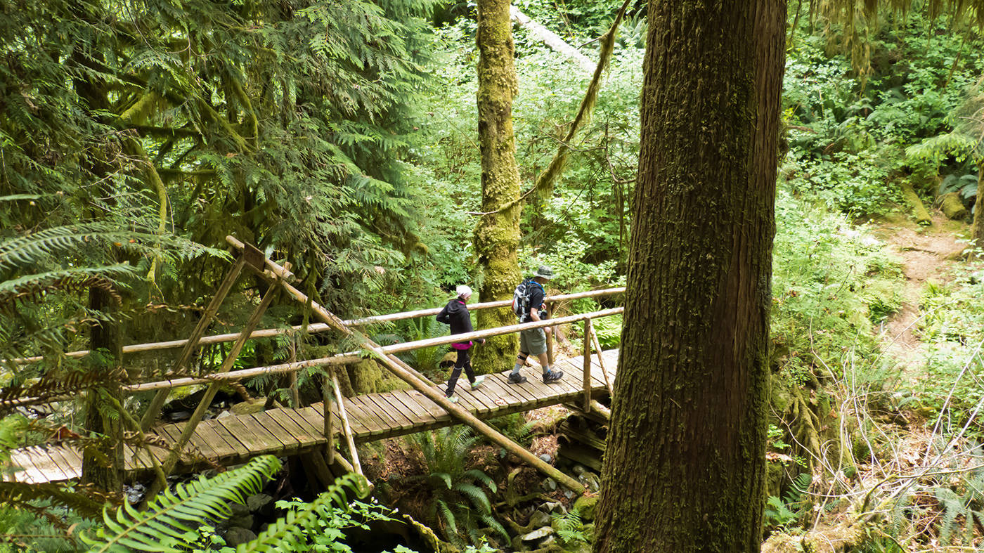
Stage 1 begins just south of Port Alberni off the end of Anderson Avenue. It is the most rigorous of the three stages. There is a good deal of hiking up and down. This stage starts by climbing steadily up the lower slopes of Mount Hankin, locally known as Copper Mountain. Part of it follows an old trail built by miners in the early days of the town’s history. The next section is intersected by logging roads and you need to watch the signage carefully.
There are several good viewpoints including looks at Mount Arrowsmith, the city looking north across the valley to the Beaufort Range and of the Inlet itself. This stage ends after 14 kms at the road into China Creek Marina and Campground where you will find a places for tent camping for those who want to continue on the next stage the next day. You’ll also find a lovely south-facing beach, showers and laundry facilities there as well.
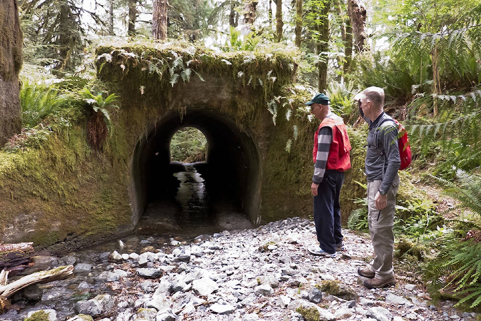
Stage 2 is much flatter after the initial descent through a young plantation to Underwood Cove where there is a short side trail to Underwood Point. After Underwood Cove the trail picks up an historic old railway grade with a unique concrete culvert dating to 1913. The trail continues along this old trail for several kilometres and through several gullies where you can find the remains of old trestles. The trail definitely isn’t very flat through these. Otherwise this portion is quite flat.
As you approach the end of the second stage the trail turns away from the grade and climbs a bit before arriving at the parking area near Franklin Forest Products. Along this 10 km stage there are several side trails that follow creeks down to small beaches with views of the inlet where you can watch the fishermen in the summer and perhaps see one of the ships coming to pick up logs from the port, or leaving with a load of them.
Ironically stage 3 has been built, ready for traffic, for a year or so. But it is not yet open to the public. There is just one problem. A bridge needs to be built across the Franklin River. There was a bridge there, but, it was condemned and now it has collapsed. This stage of the trail mostly follows the same level railway grade except where it winds in and out of the gullies where the rotten old trestles are.
After 10 kms, the trail ends at the end of a dead end road near Headquarters Bay.
The trail is also part of the proposed Vancouver Island Spine Trail that goes right from Victoria to Cape Scott. Much of it is already built. But there are still gaps: along the Beauforts, above Buttle and Upper Campbell lakes north of Strathcona Park, and Stage 3 of the Alberni Inlet Trail. It is seen as providing a second wilderness pilgrimage on Vancouver Island besides the West Coast Trail. What’s not to like about that?
The concept of the Alberni Inlet Trail has been a dream for a number of people in the Alberni Valley, particularly of Harold Carlson. He with his crew of intrepid trail builders built or cleared the entire length of the trail, arranged grants for the bridges and assisted in their construction. Work began on it around 15 years ago. The project is tantalizingly close to completion. But there is the matter of this missing bridge. The Alberni-Clayoquot Regional District is dragging their feet on this.
The ACRD’s lands and resources coordinator, Heather Zimmer, says that the board has not given the OK to get the engineering done on it to enable the regional district to seek grant money for construction. So it is still likely to be a couple more years before we see a bridge built and the trail completed.
If you want to see this finished, you might try sending messages to the ACRD board urging them to give the direction to staff to get the Alberni Inlet Trail finished.