By SANDY MCRUER
Special to the News
Over the last two-and-a-half years that I have been writing this column for the Alberni Valley News, I realize now that I haven’t done one on the Log Train Trail. So I guess it is time to kick this old political football around a bit.
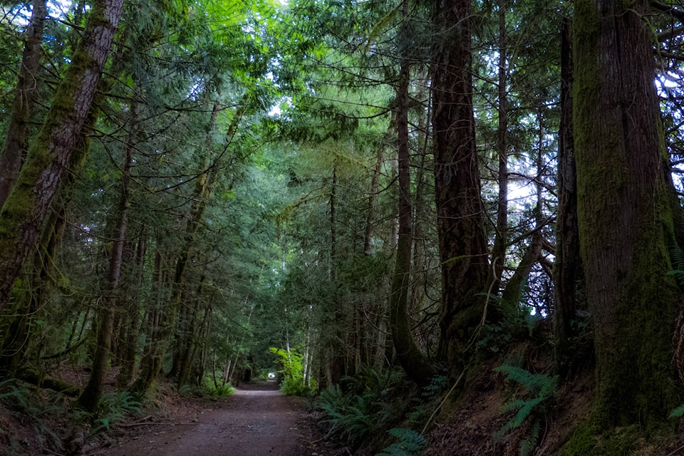
A lot has changed since Frank Stini committed his heart and soul into the creation of this wonderful recreational corridor. He was a tireless advocate for a trail network based around it. And he not only advocated, he actually did most of the work to repair and rehabilitate the old overgrown rail grade to a 20-kilometre trail used by many people and user groups.
But there are still issues with it; issues that seem to be a long way from being resolved, and keep it from being a prominent part of the region’s tourist attractions.
First, there is its length. It’s about a half-marathon long. For most of us that’s too long to hike in a day, let alone go out and back. Even on bicycles it is a very long ride. And for quads, well really it’s not a problem!
However there are access points along the way. And therein lies an opportunity for realizing some of its potential. By breaking the trail into bite-sized portions using these access points we can make the trail more accessible. These portions could be referred to as Stage 1, 2, 3, and so on. Then maps could be created for each section and publicized separately, making the trail less daunting.
The lack of wayfinding signs is also an issue. This is most apparent at the McLean Mill access. There are no signs on the McLean Mill property telling visitors about this trail and how to get to it. From the mill the gravel road goes past the steam donkey and Oldtime Logging Show site, and then you have three opportunities to get lost.
The first is a left off the road taking you toward an old poplar plantation and a clearcut. Next there is another left turn. After that, you come to a cross-road. You go straight through.
Finally the road ends at the Log Trail and you finally come to a sign. It tells you that you are at the trail and there are a couple of confusing arrows about other trails.
Then there is the confusion about where the trail actually is. If you drive up Burde Street in the city, you come to a yellow gate with a kiosk and a map beside it announcing that it too is the Log Train Trail. Nothing on the sign suggests that it is part of the 20 km trail extending out the Alberni Valley. The city’s website, to its credit, mentions that this trail is part of the longer one. On the other hand, the Alberni-Clayoquot Regional District’s site says nothing about an extension of the trail running between the south end of Maebelle and Burde Street. Neither does a brochure of the entire trail on the website.
On the ground, the south end of the trail ends at the north end of Maebelle. No sign lets a visitor know that the route continues down to the south end of Maebelle where the Rogers Creek portion of it begins at the Port Alberni Highway (Redford Extension). Alas, jurisdictional silos seem to have confused the issue.
Significantly, the first three kilometres starting from the south end of the trail is owned by Island Timberlands. So that’s from the north end of Maebelle to Milligan Road. Unlike Stage 1 of the Alberni Inlet Trail, there is no user agreement between Island Timberlands and the ACRD.
Finally the maintenance of the trail has to be addressed. A number of years ago Hal Creek sent a mass of water and debris down the Beauforts, wiping out about 50 metres of the trail and preventing foot or bicycle passage. There have been no repairs on it and no plans to remedy the situation. There is a quad trail on the uphill side that allows them to pass. There is a ford along it. So be sure to wear water sandals.
However, this detour is not on the official right-of-way.
Personally, I think it is preferable to do the trail on a mountain bike. But people take their horses on it and walk their dogs there as well. All-terrain vehicles or quads also frequently use it. However the current lease the ACRD holds with the Ministry of Transportation prevents their use. This has caused some friction between user groups. And the fact of the matter is that a large number of the people who use the trail drive quads on it disregarding this condition. I think it is time to accept this and put language into the lease to permit responsible use by quads.
The Log Train Trail is a significant part of the settlement heritage of the Valley. Although it is very long, there are some beautiful views of the valley along it, and many other trails leading off it. It should have a higher profile to locals and visitors.
But currently because of a lack of funding, and jurisdictional hurdles, it doesn’t.
However attitudes appear to be changing. It has been recognized that the trail cannot be maintained through volunteer labour. For instance, this year a small project is planned to improve drainage along the portion between McLean Mill and Desmond Road in Cherry Creek.
And that’s a good start.