SANDY MCRUER
SPECIAL TO THE NEWS
Have you ever noticed how few trails there are around the valley that are loops? It is so nice not to retrace your steps when you are out for a walk or a hike. Well, the GreenMax Trail in one of the few where you can do a loop.
You can find it if you drive out Coleman Road toward the airport. Instead of turning left onto the Airport Road, turn right and follow the gravel road for less than a kilometre until you see a road on the left and a kiosk with a map on it. That’s the trailhead. The map actually shows the loop. But it is a little complicated so I recommend you take a photo of the map when you start. The route includes both the GreenMax Trail and the road network in the woodlot. That means there are several forks in the road along the way. There are no wayfinding signs, so a map is quite important.
The loop starts with a walk along a road through the GreenMax Woodlot, a tract of Crown Land licensed to David McBride to manage sustainably. From what I can see he is doing a very good job of it. Although you will encounter clearcuts, they are all quite small and big old trees, remnants of the former stand, are scattered through them. At this time of year you can see a good supply of planted and naturally seeded trees coming up through the vegetation.
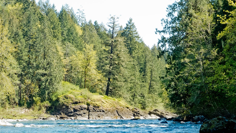
The road ends and the trail down to the river begins. This is where it gets pretty steep with switchbacks. It’s pretty short though. In 300 metres you are at the Stamp River, at a part where there is deep, mature forest on both sides, rushing water and several sandy beachlets. This part of the trail goes upstream all the way into Stamp River Provincial Park to a place known locally as Eagle Rock. Despite fishing being banned in this part of the river, it is a favourite haunt for poachers. For good reason! It looks over one of the most amazing places to see salmon in the river. In season, there are teeming schools of them waiting for their turn to go into the canyon below Stamp Falls.
If you want to do a loop, though, you’ll have to turn off before you get to Eagle Rock. There are two possibilities. The first is about 600 metres upstream from where you first came to the river. If you get to the swimming hole, you’ve gone a bit too far. It climbs back up the bank to a different road. But the climb isn’t as steep as the way down. After that, it is easy walking along the gravel roads back toward the trailhead. The loop is about six kilometres and on a nice day you can enjoy great views of the nearby mountains.
The other loop I haven’t tried yet. It’s another kilometre further up and, like the last one, you climb up to another road. That would add another kilometre to the hike.
If you want to go all the way to Eagle Rock, that’s almost another kilometre, and the trail is much rougher, harder to follow and very steep in places.
The area is quite popular with locals. Some enjoy family outings, while others walk their dogs. And still others hike down to the river to fish in the places it’s legally permitted.
The GreenMax Woodlot and the GreenMax Trail are good low-elevation places to hike on a nice winter afternoon. They are easily found, close to town and unlikely to be snowbound.