BY SANDY MCRUER
Special to the News
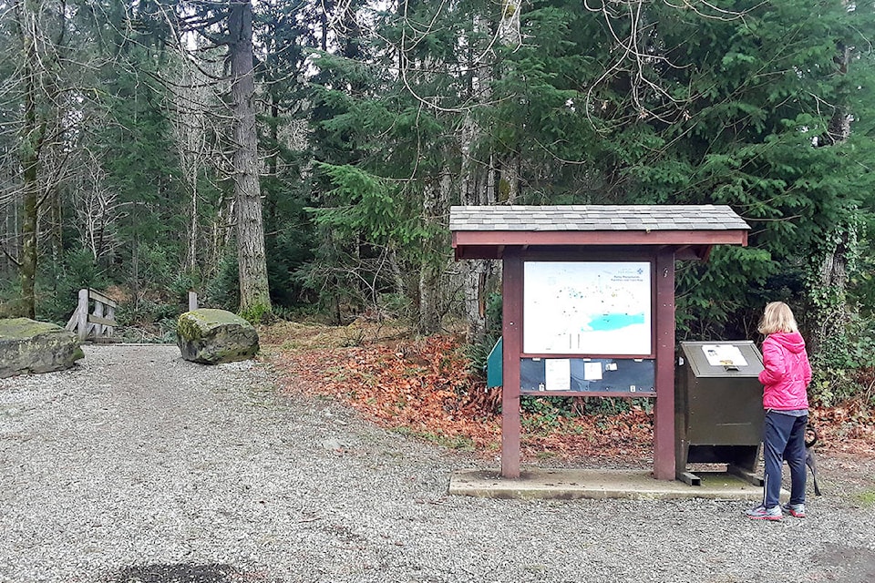
Perhaps you’ve noticed the kiosks scattered around the city at the trailheads of the urban trails around Port Alberni. There is one at the upper Burde Street trailhead, another at the fairground trailhead, yet another across from Maquinna Elementary School. There’s also one at the end of China Creek Road that was smashed by a tree in the last big storm.
Each of them has a very faded map of the trail system on it. And for years I’ve grumbled away to myself about this sad state of affairs. The maps are exceedingly hard to read. Not just because you can’t see any of the roads on them, but also because they are turned sideways so north points to the left. So I thought I would vent in my column.
And it’s not just me, I happened to meet a woman from out of town at the Maquinna Trailhead. She was most confused. She was from Calgary and was visiting her parents. Although she had grown up near the school the forest across the street was just bush then. So she was pleased to see the trail, but the map, not so much.
The first thing she asked me was if there were any loops she could walk. I couldn’t help but think of my last column on the GreenMax Trail out by the airport, which has a loop option.
Anyway, as I had decided to write on this subject, I thought I’d better do some research and be sure of my facts. So I called Rob Gaudreault, Parks Operations Supervisor at the City of Port Alberni, to see what he had to say.
I was happily surprised. He said that he was planning to replace trail signs. He also talked about replacing and adding signs at each “finger”. I think he means fork in the trail. He wants to establish a colour-coded system of dots so you know where you are.
Anyway, he told me he was studying what to do and asked for my input. I was flattered, of course. And I trotted off to write a completely different article. So here are some of my observations and suggestions for signage. They’re just mine. I’m sure he would welcome anyone else’s opinion about these signs.
The first thing I would say is, copy the style that the Alberni-Clayoquot Regional District has used on the kiosk at Roger Creek Nature Trail. It has been there for years and it hasn’t faded. It is very clear. North is at the top of the map, there are contours. Private, public and institutional land is colour-coded. There is enough contrast on the map that a person can photograph the sign and use the photo as a map on their hike.
What the Roger Creek Nature Trail isn’t as good at is providing signage at trail forks and the trail system can be a bit of a labyrinth in places. The city’s signage at trail forks is pretty good, but they are looking old. I’m not sure a dot system is better than what is there now. As it is, they are clear enough. New wayfinding signs are a necessity. But they need to be consistent throughout the system. It could be cheaper to add to the existing system rather than change it.
I’m sure Gaudreault has plans to install kiosks at the three trailheads along the north side of the Scott Kenny Trail; at the end of Tebo Avenue, the end of Cherry Creek Road and near the SPCA at the end of Broughton Street.
The only other thing is to make the map available as a PDF for people to download and the folks at the Alberni Valley Chamber of Commerce’s visitors centre to hand out.
Gaudreault says he wants to have this project completed this year. He is in the preliminary stages of designing the trail signage plan. So if you have any suggestions now is the time to put finger to button.