BY SANDY MCRUER
Special to the News
I’ve never biked to Sproat Lake before until the other day. I’d never really considered it a fun thing to do. In my mind, the choices were either to take the highway and put up with speeding traffic and a long strenuous climb up Watty’s Hill, or to cycle up the McCoy Lake Road which is also steep, winding, without shoulders, but with the occasional speeder.
But there is a very pleasant third way I hadn’t considered until I met a couple with bicycles on the Ash Main bridge over the Sproat River. And I wanted to test it out sometime. So, recently, I did.
The route follows Hector Road. After the Orange Bridge follow the highway around the river bend past McCoy Lake Road. When the highway bends left up Watty’s Hill, stay straight and follow Hector Road through the Tseshaht Reserve. At first a white line is painted on the road to separate pedestrians (and cyclists?) from vehicles. But it stops after the Tseshaht Park at Papermill Dam. The white line picks up a couple of kilometres later, but it is quite worn, almost invisible in places. Most importantly, the hills are gentler than the alternatives.
Arrowvale Campground is the next landmark. Anne and Bob Collins have run it for years. It is a converted gravel pit, but it has been nicely revegetated. There is a small café where you can pick up a cold drink, if you forgot to bring water.
Just around the corner is Somass Park. Strangely, it is owned by the city. The entrance is off Service Road which is the next right off Hector Road. There is no street sign for it unless you mistake the sign saying “No Thru Road” for the name of the road. It offers a short walk through some amazingly huge trees to a wooden tower supporting a cable car across the river. It is locked up except when it is used by Fisheries people, to monitor the fish going by I suppose. The path continues past it in a diminished form and comes out at the Arrowvale Campground. It’s primarily used by fishermen.
But if you decide to stay on Hector Road, you will eventually come to Nagaard Sawmill. Just past it, the road forks. Take the left fork. The other one is a private driveway. There is a steep, but short pitch that levels out quickly as the road passes a few small acreages. One is selling fresh eggs.
Then after a bend to the right you’ll find yourself on the most pleasant part of the bike ride. It’s a deeply-shaded old railway grade above the Sproat River. The gravel surface has a few easily-avoided potholes. A turnoff to the right leads to a gate and a very steep grade down to a second city park, Seaton Park. It is situated on a bend in the river. It is sadly neglected now. But at one time there were several campsites and picnic tables which now are so badly vandalized as to be unusable. Sigh. Let’s move on, eh?
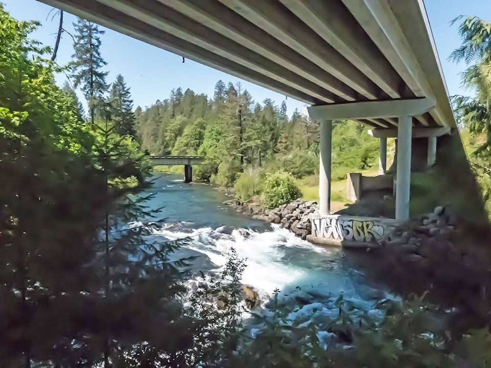
The gravel railway grade continues upstream through big second-growth conifers and shady maples to the next landmark. It is quite spectacular: it’s the cliff above Sproat Falls. It is only 100 metres or so from the Highway 4 bridge. From the top of the cliff you can see straight down into the falls and the fish ladder on the other side. In June when the Sockeye salmon are in the river, it is a magnificent place to see the masses of these fish migrating up the falls and through the fish ladder.
Personally, I think that it is one of the best places for travellers to see this spectacle on the Island. Conveniently, it is only two minutes off Highway 4 to Pacific Rim. So for those who are on a tight schedule to get to Tofino, they can take a much quicker peek, than if they had gone to Stamp Falls. The best viewing location is up a very short path through the bushes.
The grade carries on under the bridge and you arrive at an intersection with an old logging road known as Ash Main. Here you can either carry on to Faber Road by turning right and meeting up with a walking/ biking trail that parallels this road. Or you can turn right and cycle across an old logging bridge and on to Sproat Lake Provincial Park.
It is a wonderful route for people to consider for an afternoon’s bike ride, whether you live in town or at the lake, or even if you are a visitor camping at Sproat Lake Provincial Park. I’m glad I tested it out.
And I think it could be considered in some official way as the Sproat River Bicycle Path.