Sandy McRuer
Special to the News
Here’s a trail where you can cross two little bridges, explore two groves of old growth forest, stand at the top of a cliff, visit a camas meadow and also visit an exquisite little waterfall; and you can easily do it in an afternoon.
To my mind it is a wonderful alternative to the hole-in-the-wall, just down the road, but ramped up a little. It’s an obscure, little-used trail off the road to the Black Powder Gun Range, home of the West Coast Rangers Black Powder Club. And that road is 500m up the road from Coombs Country Candy.
On the right is a road heading down toward the trees with a gate that’s usually locked. But there is a three-vehicle turnout where the road meets the highway. This is the safest way to approach the trailhead. You have a 600m walk along gravel roads and three left turns ahead of you. At the end of the last road is the trailhead. One can drive this far if you have a vehicle that can get through shallow gravel bars. There’s enough room to turn around at the end, and squeeze in two vehicles.
The trail is sometimes hard to follow as it needs to be brushed out. So if you are so inclined, you could do what Judy Carlson is famous for doing, carry some hand pruners to trim the brush as you go. A few ribbons are hung along the trail, watch for them.
You start in the middle of a healthy plantation of third growth Douglas Fir. Nearby is a patch of second growth, left as a retention element to break up the visual impact of the clearcut.
The trail leads downward toward the edge of the timber.
Once you are there, the trail becomes more easily followed. It leads to a little babbling brook with a rickety old bridge across it.
I have no idea who built the bridge, thank you whoever you are. It will easily bear my weight, (175 lbs if you have to know).
There is some windthrow along the trail, so you’ll need to be pretty agile. From the creek it leads up to a little plateau and you cross it. On the far side the trail heads up a steep hill at the top of which there is a lovely grove of old growth forest at the top of a cliff made of conglomerate.
At the top the trail forks, on fork leading up to the camas meadow and the highway, and the other fork down to the waterfall. Also in the meadow are a variety of other lilies like Nasturtiums and Grape Hyacinth. All put on a good show in May.
On the way down there is another fork you could easily take in error. Take the choice leading downhill and not across the hill.
However, it’s very steep. Here, the trail leads out to a hogs back, and down one side of it to a creek and another bridge and the biggest Douglas fir around, a big old survivor of the original logging.
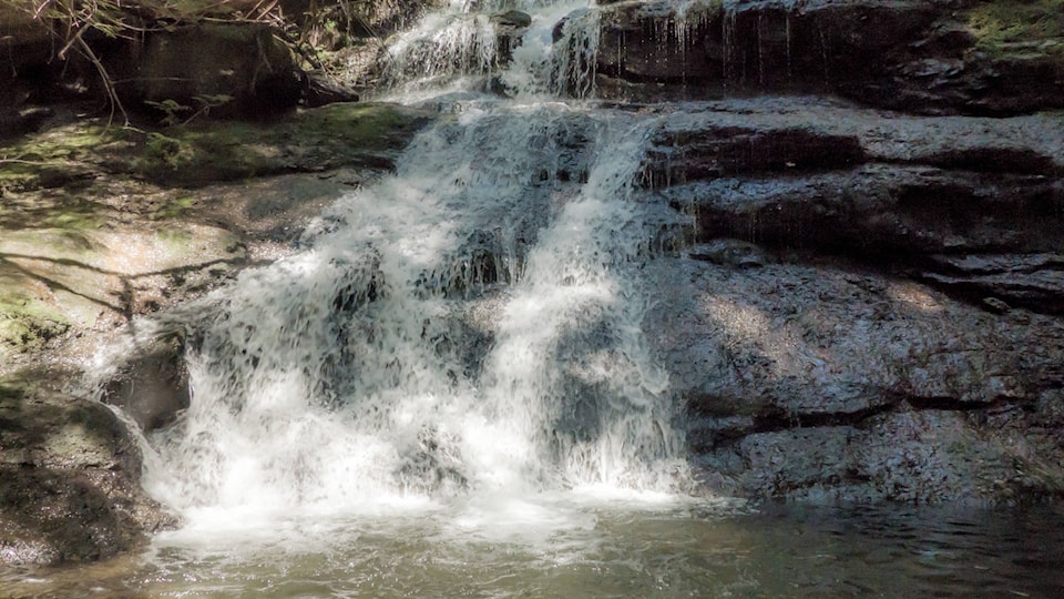
You will hear the falls before you see them. Rather than plunging over a precipice, the water flows over a series of ledges and into a small pool at the bottom.
From the turnout by the highway to the falls, it should take you an hour at a very leisurely pace. But If you want to hang out at the falls or admire some Indian pipe, or explore more, that’s your business.
Interesting fact: the source of Stokes Creek is Loon Lake.