BY MIKE YOUDS
Special to the News
Prompted by pressures from development, recent storms and a climate in flux, the Alberni-Clayoquot Regional District (ACRD) has embarked on the first comprehensive mapping of the Somass River watershed.
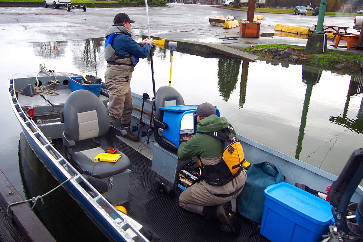
For the past two weeks, a bathymetric survey crew has been slowly cruising the river and its tributaries, measuring flow and charting the riverbed as initial steps toward improved flood management in the Alberni Valley.
Funded by a $500,000 grant from the federal-provincial National Disaster Mitigation Program, the mapping of the Somass is one of 32 such projects in B.C. that received a go-ahead in November.
“Really, at this stage, a lot of what we’ll be doing is data collection and a lot of it now is field work,” said Mike Irg, ACRD manager of planning and development. “What it will do is give us more flood mapping and establish the flood levels. We’ll use that information to improve our zoning bylaws.”
Irg said the existing floodplain mapping was done more than 25 years ago and does not encompass the whole of the watershed, 1,400 square kilometres in area. Flood events over the past five years contributed to a decision by the previous ACRD board to apply for the grant funding, he noted.
Nanaimo-based Northwest Hydraulic Consultants is relying on guides with Murphy Sportfishing to navigate the river and its major tributaries using an aluminum skiff. Field work, including use of Lidar and aerial photography, will amass the data required for computer modelling, a key tool in flood planning.
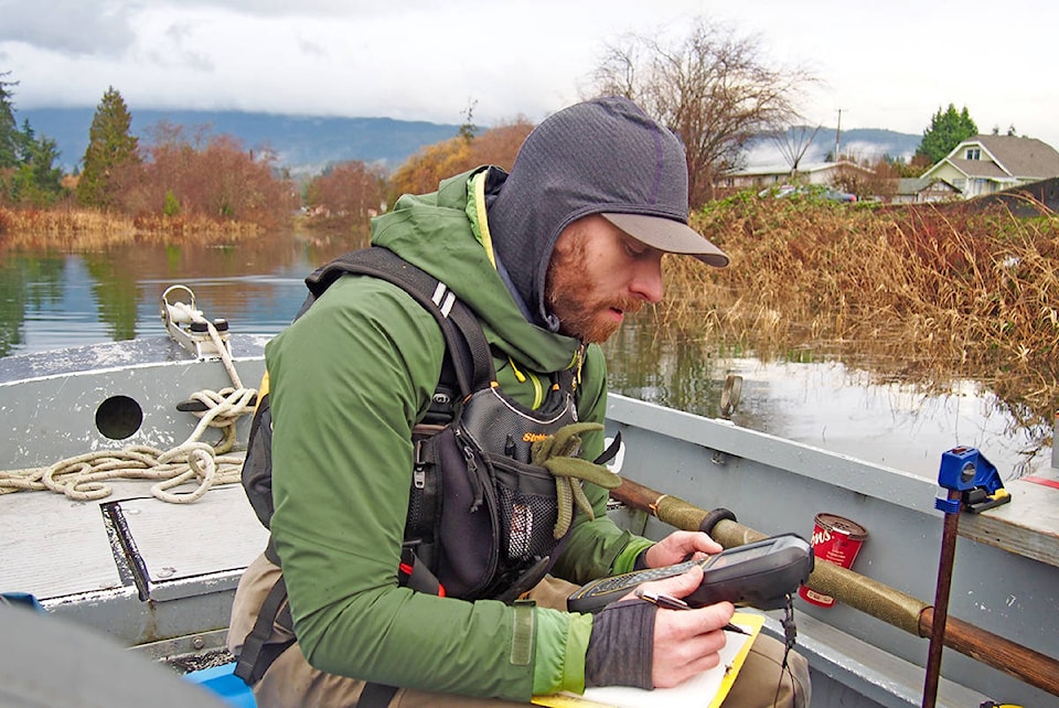
“What we’re doing is basically mapping the riverbed,” said Will Skitmore, a geomatics specialist, as the crew headed out. Using an array of tools including GPS, sidescan sonar, hydro acoustics and airborne remote sensing, their work covers the Somass and major tributaries, including Stamp and Sproat rivers as well as Kitsuksis Creek. They expect to be on the water for at least another three weeks.
“Then the modellers take over,” Skitmore said.
“This will give us new 200-year flood mapping based on professional engineering standards,” Irg explained. They will be able to use the mapping to determine zoning and flood prevention measures.
The national effort to develop improved floodplain mapping is intended to help communities adapt to extreme weather now widely acknowledged to be at the forefront of climate change.
Chris Alemany, an amateur weather observer, applauds the floodplain mapping and feels a fuller analysis should include land-use impacts within the watershed. The Somass project will provide a piece of the planning puzzle, he believes.
“There’s so much change happening very rapidly right now,” Alemany said. “Data collected 10 years ago is probably not valid anymore. The data has to include potential effects from industrial, residential and commercial activity in the area.”
In a recent letter published in Alberni Valley News, the former city councillor urges residents to pressure elected representatives for greater local authority over adjoining watersheds that supply the city’s drinking water. With continued logging in the watershed, the city may have to eventually build a costly filtration plant such as the one Nanaimo relies upon, he said.
December’s powerful windstorm — which knocked out power to 750,000 B.C. residents and caused more than $37 million in property damage — provided clear evidence that the valley needs to take a more active role in protecting its drinking water, he said.
“That’s not something we’ve ever seen before to my knowledge. Whether it’s impacted the watershed, I don’t know. It’s all interrelated. One of the things to protect against blowdowns is to have intact forests.”