SANDY MCRUER
SPECIAL TO THE NEWS
It took two attempts, but now Mount Porter is off my bucket list. It isn’t a high mountain, or a dangerous one, or even remote… anymore. For those who don’t know where it is, it’s that broad ridge that forms the height of land between Sproat Lake and Great Central Lake. I’m not sure why, but I’ve always wanted to see the top.
I’d pretty well decided it may not happen as the summit had become quite remote. An access road to Doran Lake gets you a little closer to the summit. The turnoff to the lake is just west of where the Taylor River flows into Sproat Lake. Years ago, it was the best access to the summit. It deteriorated until it was grown over and water-barred, inaccessible to all but possibly quads or trail bikes.
I still considered the area worth exploring though. So I called up Jim Wright and asked him if he wanted to hike up to Doran Lake and do a little birding (bird watching) on the way. When we got there I was surprised to see the road in pretty good shape. The lake is nine kilometres along the road and almost a 700-metre climb. We drove about halfway up and stopped, because this was, after all, supposed to be a hike. It turns out that the road is drivable all the way to the lake in a 4WD vehicle, possibly in a 2WD with good clearance. The last couple of hundred metres might scratch the paint on your vehicle though. And there is a rough boat launch and room for a tent or camper.
But I digress. A week later Jim said he was up with another bunch of hikers who turned off the Doran Lake road and caught the trail to Mount Porter. He offered to show it to me. So we went up later in the week.
To get there, drive to the end of Taylor Arm to the place where a logging road crosses Highway 4. Take the road up and then the first right when you get near the top, ignoring all the unused spurs on the way up. It is about 7 km up from the bottom. After the turnoff, the road deteriorates. We stopped about a kilometre after the turnoff and continued on foot. It was almost 2 km to the edge of the timber.
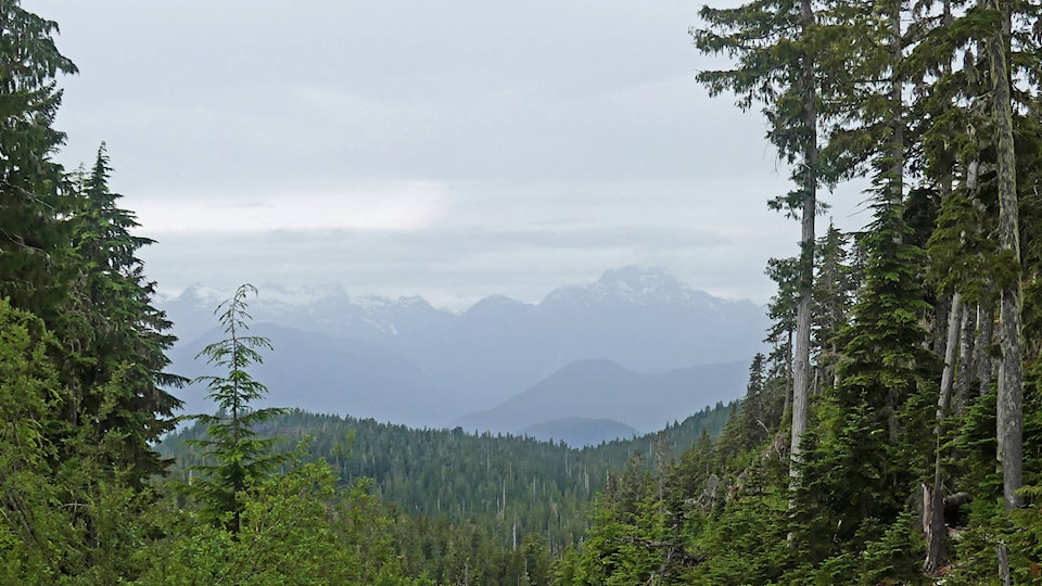
After that, the trail is well marked for the most part. There are a couple of spots where it isn’t obvious. But since we were walking along a ridge, we were able to find the trail again easily. Jim said that on his last trip they came across a group of guys on trail bikes who were brushing the trail and cleaning up deadfall. Thanks, guys! We stopped once on our way up at a viewpoint over the Taylor River, Mount Klitsa, Adder Mountain, and beyond.
The top is not quite alpine, but there are wonderful views in every direction. Both Sproat Lake and Great Central Lake are spread out below. And toward the north and northwest, the Comox Glacier is visible as well as the mountains of Strathcona Park. Looking the other way are the arms of Sproat Lake, Mount Klitsa, Adder Mountain and Nahmint Mountain.
So if you have the right vehicle, this area around Doran Lake and Mount Porter is now very easily accessible for day trips or secluded overnight camping. Overgrown spurs serve as ways to get to a few other small lakes and ponds in the area. The hike up the mountain is 4.5 km each way and the climb is around 500 metres. Happy Trails.