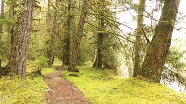
A gem of a trail winds its way along the Stamp River downstream towards Stamp Falls. This trail is variously called the Angler’s Trail, Stamp Long River Trail, and Sayachlas t’a saa’nim in the Hupacasath language.
This trail was constructed nine years ago by the same dedicated group of people who are building the Alberni Inlet Trail. And they are building these trails with a vision in mind.
The vision is to have a regional trail system that links to other regional trails in other communities on Vancouver Island. And this vision is slowly becoming a reality.
On the other side of the river and downstream from the Stamp Falls Provincial Park boundary, there is the Green Max Trail that runs from somewhere near the boundary of Stamp Falls Provincial Park down to the end of Coleman road along the west side of the river.
Then there is an obscure piece of Crown Land just north of the confluence of the Stamp and Sproat Rivers where a local trail has been established to bring you to Mackenzie Slough. Further downstream below the confluence, there is Somass Park, a city-owned property sandwiched between Service Road North and Arrowvale Campground.
Still further downstream below the Tseshaht Reserve is the road leading to the Somass Estuary Ducks Unlimited property.
From there the route could turn inland and follow Rogers Creek up to the Rogers Creek Nature Trail until it comes to the Log Train Trail. Part of this section is under construction now. Then the route turns south and follows a network of trails behind the city all the way to Ship Creek Road.
From there it links up to the Alberni Inlet Trail of which stages 1 and 2 are completed and stage 3 is almost complete. The section is the Runner’s trail that heads inland toward Lake Cowichan, but ends at the old Franklin Camp.
And finally the Tuck Lake Trail takes you to Alberni-Clayoquot Regional District Boundary just west of Cowichan Lake.
One side branch of this trail could extend over the shoulder of the Beaufort range from Cherry Creek to link up with a trail that goes up from the mouth of the Big Qualicum River to Horne Lake. Another could branch off from Hector road and follow the old road up the Sproat River to Sproat Lake Provincial Park, and beyond to the Bomber Base.
This is an impressive length of trail. From above Stamp Falls to Franklin Camp is roughly the length of the West Coast Trail. But there are gaps along the way. Several of those gaps are because of private property. Negotiations with land owners and local First Nations would be needed in order to attain agreements to cross these lands.
Agreements have been successfully achieved with Island Timberlands, and so there is a precedent.
Some of the gaps are also because bridges are needed. Some of them can be quite simple affairs such as the one across St. Andrews Creek and some of the other smaller creeks in the existing network. But there are also some very significant ones where a crossing may just not be possible and a re-think of the route may be necessary.
It’s a big ambitious vision. And it is part of a larger vision, to have a trail the entire length of Vancouver Island. This initiative is called the Vancouver Island Spine Trail. Much of this route has been completed. And I believe that it will be completed in the future.
Once it is in place it will be possible to hike from Victoria to Cape Scott. What a magnificent ambition.
For more information on the Vancouver Island Spin Trail, use this link. http://www.vispine.ca/.