SANDY MCRUER
SPECIAL TO THE NEWS
Pretty much everyone from town knows about the Alberni Valley Lookout. It’s very popular. Besides hikers, I’ve seen mountain bikers, 4WD vehicles and ATVs up there, as well. Over the years there have been protests and parties, too. You don’t need to have lived long in the Alberni Valley to know about it. But there is another lookout in the Valley—one that few people get to because it isn’t as convenient.
The Sproat Lake Fire Lookout overlooks the lake from a hilltop 650 metres above sea level. It was used up until the late 1970s before it was replaced by lightning detectors. Only the foundations are left now, as well as a cache of rusting D-cell batteries and other remnants of occupation. And a curious plaque with the name “Douglas Love” is cemented to the rock the foundations are on.
In its day, it was called the Stamp Forest Lookout. The view is fabulous, and would have been even better from a tower 50 feet in the air. Taylor Arm, Kleekoot and the Stirling Arm of the lake are laid out below you, as is the Alberni Inlet, Port Alberni and the Beaufort Range across the valley.
Getting there is easy…at first. Take the highway out of Port toward Sproat Lake until you come to Sproat Lake Landing Resort. Instead of turning left into the resort, turn right and then right again immediately. You go up to a third intersection, a T-intersection, and go left. Stay on this road until you get there. There’s steep gravel on the way up. I turned the 4WD on when the wheels on my SUV started spinning and made it up easily. A 2WD could do it, but you’d beat the heck out of your car. After half an hour, you’ll come to another intersection and you’ll be 230 metres from the trailhead. You can park at this junction so you don’t block the road and then go left until you see an old skid road going up the hill to your right. That’s the Wolf Claw Trailhead. It’s all uphill from there.
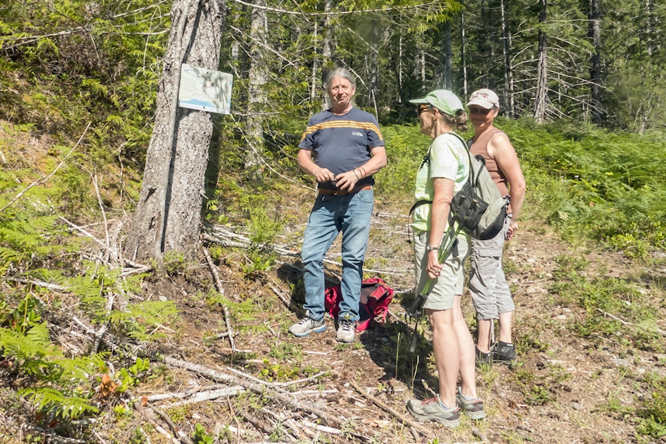
Look for an old sign nailed to a tree that has a map on it with all the trails in the area and a “You are here” dot. At first, the trail leads upward steeply, stepping over or onto roots and rocks as you hike through the forest. It’s a dry south aspect and there are no creeks. Bring water. About a third of the way up, there is a short detour for a nice view of the valley and a chance to rest. After that, it’s a little flatter. The forest is dry and open as you wend your way through short glades of old forest mixed with younger forest and flat rocky bluffs. As you near the top the trail, you enter a magnificent stand of old ancient forest before another steep climb to a grown-over road. You only go a short way along the road before climbing a final steep pitch to the top. It takes about 1.5 hours at a relaxed pace, stopping periodically for a drink or clothing adjustment.
The top is a large area of relatively flat rock. It’s fun to explore and a great spot for a picnic.
When you feel like moving again, you can take a different trail down. It’s called the Montiel Trail, named after Mexican anti-logging peasant activist, Rodolfo Montiel Flores. The trail is similar, only steeper and a bit shorter. For those with joint issues, hiking poles make a big difference. You come back to the road about 100 metres beyond the first trailhead.
As you take the same road back down, you may start thinking about what a nice day it is, and wouldn’t it be nice to relax with a cold drink soon. We did when we were last at the lookout. And we thought about how convenient the Sproat Lake Landing Resort was.