Part one of a series
The Alberni Valley is full of diverse animals, landscapes and plants—but what about what lies under the surface?
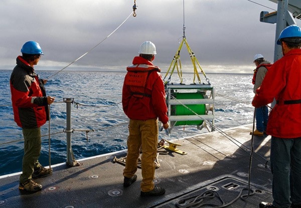
Port Alberni is home to NEPTUNE, an Ocean Networks Canada research facility that includes an 840-kilometre loop of fiber-optic cable on the sea floor that allows scientists, governments and the general public to see what’s happening on the ocean floor.
But while the 130 instruments provide a host of data on what’s happening in the depths of the Pacific Ocean, Ocean Networks Canada wants to know what’s happening a little closer to shore.
“NEPTUNE starts in Port Alberni and then it runs its 800 kilometre loop offshore and it’s collecting data from all kinds of environments—but they’re very offshore environments,” said ONC business analyst Teron Moore.
“So it’s interesting science but it misses out on some of the interaction that’s closer to the community and that’s an area we’re interested in studying closer.”
To that end, Ocean Networks Canada has identified the shoreline of the Alberni Inlet as a location for a possible community obser-vatory—a small station that will look at ocean data close to shore.
(story continues below)

Port Alberni’s unique geographic location makes it an especially valuable research location.
“For science, it’s an interesting area,” said Moore.
“You have the interaction between the ocean and the inlet, the tidal influence, the river coming out and the community itself.”
It’s also a logical choice because of NEPTUNE’s presence.
“That’s a location where we already are so we have a relationship with the community and infrastructure there so it just makes sense.”
Moving closer to shore makes it harder to get data “unspoiled” by human interaction, Moore said, but that’s what makes it interesting.
“The closer you get to communities, the less you’re able to get data from ‘unspoiled’ environments so in terms of looking at some of these areas where there are populations that are interacting with that ocean environment, we’re able to determine some of these choices that we have in terms of development, long-term growth or sustainability.”.
The key, he added, is to get a baseline against which future data can be compared.
“This is where information and data that’s been collected over years can aid those decisions. It’s an area [of research] that’s important to understand better than we do to give decision makers that information to make better decisions for communities.”
With climate change becoming a growing concern for coastal communities, that scientific data will be more necessary in the future.
“There’s a lot of research that’s telling us it’s happening a lot quicker than it has in the past.”
According to the BC government, assuming an eustatic sea level rise of 100 (+/- 30) centimetres by the year 2100, Port Alberni will see a sea level rise of between 44 and 108 centimetres.
“Some of the research going on at Ocean Networks Canada is directly involved in climate change and looking at how the ocean system interacts with climate change, because oceans are a huge driver of climate,” Moore said.
“As the ocean changes and gets warmer, what does that mean for sea level rise? What are the impacts for Port Alberni versus Kitimat or Prince Rupert or other locations globally? Having that baseline of data is key.”
The data collected by the proposed community observatory will be similar to what NEPTUNE collects, just in a different location.
 “The community observatory proposed for Port Alberni would be seen as an extra set of data points. It’s similar types of instruments looking at similar parameters.”
Those data points will include a hydrophone, a water quality metre (to track salinity, acidity, chlorophyll, temperature), a weather station, an automatic identification system antenna (used to track vessels) and both on and off shore cameras.
Having both far out and close by data allows researchers to get a better idea of what’s going on ocean-wide.
“It helps us understand the bigger picture when it comes to say, the temperature of the ocean.”
The community observatory could also measure seismic activity—something that could be life-saving in a tsunami zone.
“When we have our own subduction event off the Cascadia subduction zone, what does that mean for the tsunami that’s going to be following? I think that’s an area where we can further our understanding.”
That’s why ONC is looking at modelling both the type and severity of earthquakes that might occur in the Port Alberni region as well as the tsunami that could follow.
“Based on what happened in Japan where the scientists were surprised as to how big the tsunami was compared to what the models were, it’s time we continue to enhance our own modelling so we can better understand what sort of tsunami might follow an earthquake at that size.”
That information would be key for disaster preparedness.
“Ocean Networks Canada is working with Natural Resources Canada and the province of B.C to determine what kind of flooding might happen from a tsunami after a large 9.0 Cascadia subduction zone event,” said Moore.
“So things like how long it might take that event to come into the Barkley Sound and into the Alberni Inlet and travel to the mouth of the inlet, and what kind of wave height or currents are we looking at.”
Getting close to Port Alberni makes the data more applicable to local development, whether it’s by businesses or governments, and will help with science-based decisions.
“If you’re not sure of the current state of ocean ecosystems or temperature or any of the current context of what the environment looks like, then as the community evolves and changes, population changes, industry comes and goes... what are the impacts of those changes on the marine environment? If you don’t have continuous monitoring then you don’t understand.”
Those data points can help with deciding pretty much anything the community does in the Inlet.
Give it half a decade, and the decisions get more significant.
“Perhaps within that five years you had an increase in industrial activity and what happens if that temperature has spiked? You might be able to correlate that industrial activity with that temperature rise.”
Since ONC is under the umbrella of the University of Victoria, Moore said that the data isn’t meant to support any one conclusion.
“We’re really hoping that having long-term monitoring in place in the community will be able to inform discussions. It’s not that it supports one thing or the other thing, it’s data that’s out there that’s freely available to anybody whether you’re a proponent of an LNG [project], a mill or whether you’re Greenpeace.”
That sharing of data is what makes a community observatory so key to increasing scientific literacy within the community and not just in post-secondary institutions.
(story continues below)

Coun. Chris Alemany, an amateur meteorologist who runs AlberniWeather.ca, says that’s more important now than ever.
“Over the past 10-20 years, I think—and whether you attach it to the rise of the internet—we’ve had a huge turning away from science. You see it in the climate change debate, you see it in anti-vaccination, you see it in all sorts of different ways. It’s just this notion that you can’t trust a scientist because they’re paid by someone,” said Alemany.
“I think stuff like Ocean Networks where it gets science into a community and makes it really accessible to young and old so that they can see it with their own eyes and it’s not in some ivory tower in Victoria or Vancouver, really helps.”
Moore agrees that outreach outside of academia is key.
“We have a great outreach program for researchers—universities, PhD students, masters students—and we deliver data and products to those clients.”
But the sort of data delivered to academics is very different from the sort of data that people without a scientific background can understand.
“With the public or school children, they need a different type of outreach.”
That’s where OceanSense comes in.
“OceanSense is all about integrating science into K-12 curriculum through the Ministry of Education so that they can integrate the science, the information and the data that’s coming off of our sensors into the stuff they’re already learning about the marine environment.”
Having a community observatory in Port Alberni would enhance that by bringing data so close to the students that they can reach out and touch it.
“It’s really integrating the students into the stuff that’s happening in their own backyard.”
reporter@albernivalleynews.com