My husband and I took a “staycation” this year instead of going to Quebec in September like we normally do, to see our grandchildren and their parents. We chose to stay in central Vancouver Island, taking mini trips to the west and east coasts. While on the west coast, I was impressed to see the work being done on ?apsciik tašii (pronounced ups-cheek ta-shee) trail, between Ucluelet and Tofino through Pacific Rim National Park Reserve.
This 25-kilometre multi-use path will pretty much complete the connection between the two coastal communities—there are already multi-use paths reaching out from Ucluelet and Tofino, but they don’t meet in the middle yet.
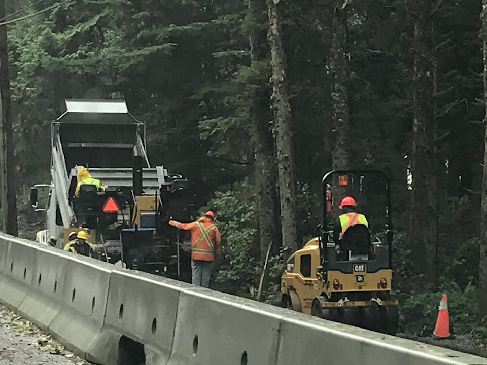
The way the path meanders through trees on the side of the road, then comes back to be separated from the highway by a concrete barrier; how trees cut down to make way for the path are being used to build bridges over sensitive wetlands or drainage areas; well, it’s pretty impressive.
The price tag is hefty: $51.1 million at last count. Because ?apsciik tašii runs through Parks Canada property, millions of dollars of grant money have already gone into construction since the project was unveiled in 2016. The other multi-use paths are already well used, so it stands to reason this one will be as well.
With this type of project happening so close to home, it isn’t surprising that the City of Port Alberni is looking at its own multi-use path connecting Victoria Quay and Harbour Quay.
There are numerous examples of multi-use paths that connect cities. Growing up in Ottawa, there was a bike path that connected the Bayshore suburb where I lived to the city proper. We were on it all the time as kids. That system has since been extended, and is well used.
I lived for a few years in Medicine Hat, Alta., and that prairie city also has a network of trails that meander along the waterfront and through town—there is even an underground tunnel below the train tracks connecting two parts of town.
It would be ideal if Port Alberni’s proposed pathway wound along the waterfront. Even if that doesn’t pan out, and the rail line has to be used, there is nothing wrong with the path passing by a paper mill or sawmill. The city was built on industry, it is still a big contributor—although not like it in the past—and we shouldn’t be ashamed of it.
Some people have been vocal about wanting a third route between south and north Port Alberni via a connector at the end of 10th Avenue. That discussion has happened at the municipal level more than once, and has been rejected every time as too expensive. Comparing a multi-million-dollar connector that would include vehicle traffic doesn’t compare to a multi-use path for walkers and cyclists.
A quay-to-quay pathway would be well used by both residents and tourists. The timeline the city has proposed is not immediate: it gives space to find funding opportunities that would take the pressure off local taxpayers. We should give the idea a chance before rejecting it.
— Susie Quinn is the Alberni Valley News editor.